
Walk a Fort Wayne Street
A street directory search works best as a chain, not as one name list. Start with the physical address in Allen County COMPS. The map and parcel card can establish the situs address, which means the location of the land, and show the assessed owner. Then move to recorded deeds and dated directory evidence. A voter status page is useful only when the searcher already has the required personal details. It cannot produce a street-wide list. Keep the source date beside each result so that an owner, voter, or directory entry is never mistaken for a current occupant.
- Normalize the number and street spelling, then search Allen County COMPS. If the full address fails, the assessor suggests a shorter stem such as a house number and street name.
- Open the parcel in the GIS viewer. Select only the needed block and note parcel IDs, legal descriptions, address points, and incorporated-area layers.
- Read each property card separately. Record the situs address, owner field, transfer row, neighborhood code, and date consulted.
- Search current and prior owner names through the Allen County Recorder. Use the ACGSI deed index for older references.
- For a past household, consult ACPL's address-first or criss-cross directories. Compare the edition year with a period map before linking an old number to a modern parcel.
The chain is address to parcel, parcel to owner, owner to deed, and date to directory. Each link has a narrower meaning than “who lives here.” That restraint makes a block study much more reliable.
Fort Wayne Address Search Fields
COMPS is the main public starting point for a modern Fort Wayne street directory search. Its simple box accepts an address, owner name, or parcel number. Advanced sales adds filters that can distinguish a sale search from a plain parcel lookup. Results may expose a parcel number, property class, neighborhood code, acreage, sale date, and sale price. These are assessment facts, not proof of a household.
| COMPS field | Input | Best street use |
|---|---|---|
| Address | Number and street text | Find a parcel; shorten the street text if an exact form fails |
| PIN | Parcel number, with or without dashes | Hold the same land key when an address changes |
| Neighborhood Code | Code from a parcel card | Define a local comparison set |
| Buyer / Seller | Name | Review named parties in sale data |
| Date / Price | From and to values | Narrow transfers by time or amount |
| Valid Sales | Checkbox | Unchecked results may include foreclosure, short, or sheriff sales |
A parcel card also separates the property address from owner information. Preserve that distinction. The mailing destination used for tax notices may be a post-office box, office, or address outside Fort Wayne.
Map Fort Wayne Streets by Parcel
The Allen County GIS viewer adds the map view that a name index lacks. Property lines and address points reveal adjacent lots. Neighborhood associations, subdivisions, incorporated areas, zoning, flood plain, tax districts, roads, and voting layers can explain why two nearby addresses route to different offices or records. Historical aerial imagery is listed from 1938 through 2021, which can help date changes in a building footprint.
Use the Identify tool on a small set of parcels, then open each result in COMPS. Selection controls can zoom to the chosen rows or remove unrelated parcels. A saved or shared map is a dated research aid, not certified ownership evidence. For title questions, follow the parcel key into the Recorder's documents.
- Parcel
- A mapped unit of land with its own county identifier.
- Situs address
- The physical location assigned to the parcel, which may differ from the owner's mailing address.
- Plat
- A recorded map that lays out lots, blocks, streets, or subdivisions.
- Criss-cross directory
- An address-first volume arranged by street, useful when the resident's name is unknown.
Fort Wayne Street Numbering Clues
Fort Wayne Code §99.111 roots the modern grid in Calhoun Street and the St. Mary's and Maumee Rivers. Numbers generally rise by one hundred per block. North-south streets begin at the rivers, while east-west streets run from Calhoun. Odd and even sides switch according to direction and side of Calhoun. The City Engineer may adjust the scheme when local conditions require it.
This numbering rule is an insider tool, not a perfect locator. It can place an address in a likely quadrant or block when a directory gives an intersection. Rural routes, annexed land, street extensions, and renamed streets still need a period map. The Fort Wayne street directory is strongest when the code rule, old map, and parcel geometry agree.
When Fort Wayne Addresses Changed
Fort Wayne's 1898 to 1902 renumbering is the key local street story. ACGSI cites a December 5, 1898 newspaper notice about a proposed house-number ordinance. Its concrete example follows John Sollberger's saloon from 232 W Main in 1900/01 to 916 W Main in 1902. A number-only search could split one place into two false locations.
Street names changed too. Water became Superior, Griffith became Fairfield, Erie became E Berry, and Walton became Anthony. The list is a clue rather than a full crosswalk, since extensions and jurisdiction changes also matter. The successful manifest capture below comes from the local ACGSI street-history source.
See the ACGSI history of Fort Wayne street names before forcing an old listing into a current address.
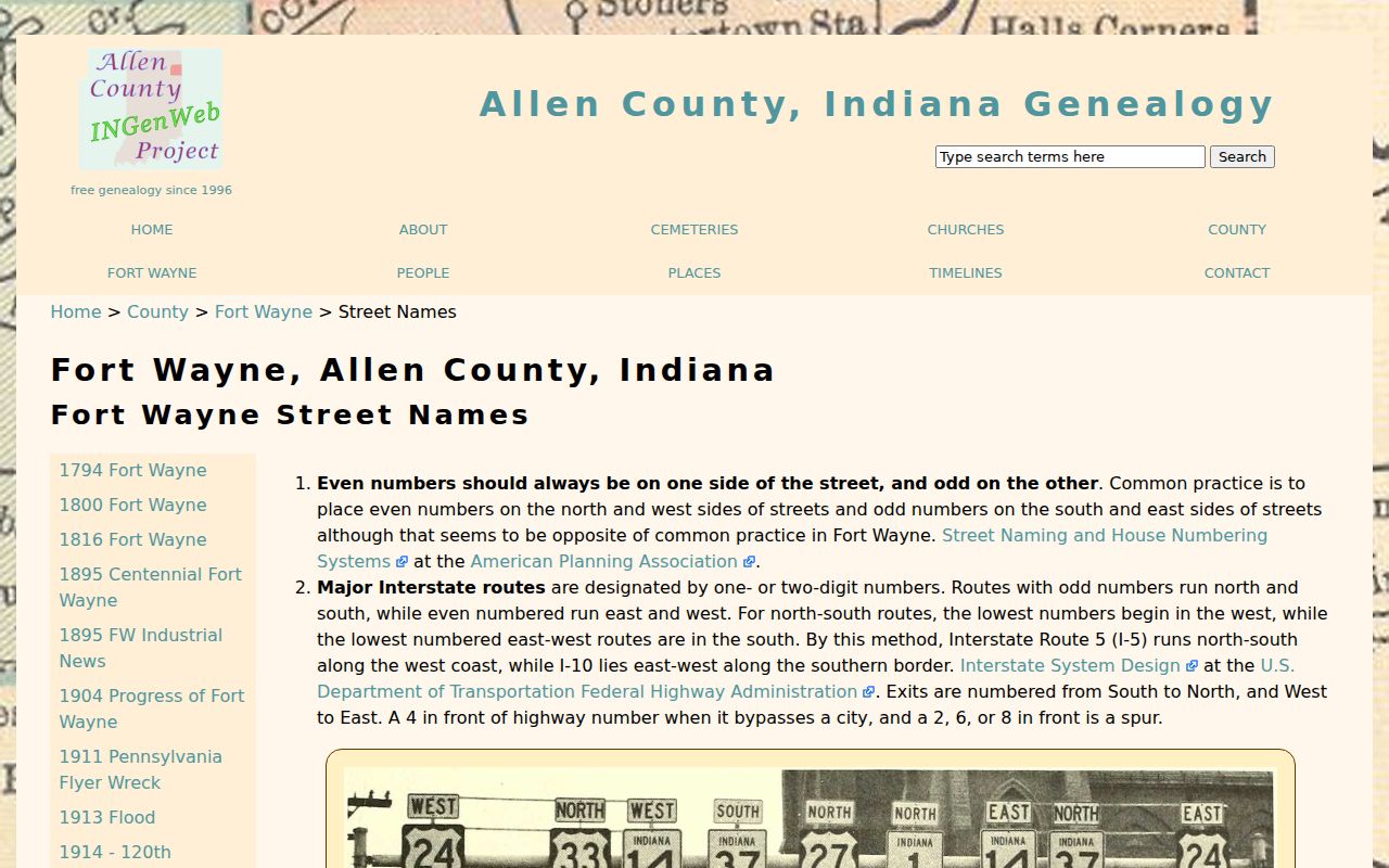
The page supplies the dated renumbering clue needed to connect a historic address entry with a modern parcel.
Fort Wayne Street Record Coverage
No single Allen County system indexes every person by street. The useful sets cover land, filings, public projects, dated directory entries, or voter administration. Read each row according to its keeper and access channel.
| Record Set | Keeper | What It Shows | Access |
|---|---|---|---|
| Property card | Allen County Assessor | Owner field, situs address, transfers, values, building facts | COMPS and PATI; office help |
| GIS parcel map | Allen County GIS | Parcel lines, address points, layers, historic aerials | Free viewer and county maps page |
| Deeds and plats | Allen County Recorder | Named parties, legal description, instrument references | Free data, paid image services, counter, phone, or mail |
| Voter information | Allen County Voter Registration | Status for a known person; requested voter data has use limits | Exact-detail state lookup or VRG-24 request |
| Permits and code cases | Fort Wayne and Allen County departments | Dated project or case records tied to an address | Accela, code lookup, City Clerk, or APRA request |
| Historical directories | ACPL Genealogy Center | Dated occupants, firms, street cross-indexes | Shelf, microform, scans, and staff help |
The parcel number and legal description are the best bridges among land records. The street text connects permits and directories, but only after spelling and numbering have been reconciled. A public voter lookup is not a street directory and should never be scraped into one.
Deeds Along a Fort Wayne Street
The Recorder holds deeds, mortgages, releases, easements, plats, liens, and other recorded instruments. Its free data search accepts an exact person or business name and provides no images. Tapestry EON covers documents from 1970 forward, offers name searching back to 1950, and charges $8.75 per search plus $1 per printed page. Address or PIN searching may not reach records before 1995. Laredo is the subscription route and resembles the office terminal.
For older parties, the ACGSI surname index covers many deeds from 1824 through 1903 and 1913 through 1999, with a declared 1904 to 1912 gap. That gap is not proof that no deed exists. Ask the Recorder for the office index, book, image, or copy needed to bridge it. The counter at 1 E Main Street, Room 100 is open Monday through Friday, 8:00 a.m. to 5:00 p.m.; phone, email, and mail are also documented channels.
Fort Wayne Cases by Address
Accela and the city's code process add an event layer to a Fort Wayne address search. A permit can date work on a structure, while a code case can tie an address to an inspection or complaint process. An applicant, owner, or case contact is not automatically an occupant. Search the address and preserve the case number, record type, status, and date.
The Fort Wayne code case instructions show the official address-based route. If a file is missing online, contact the department or use the City Clerk and Indiana Access to Public Records Act process for a reasonably specific existing record.
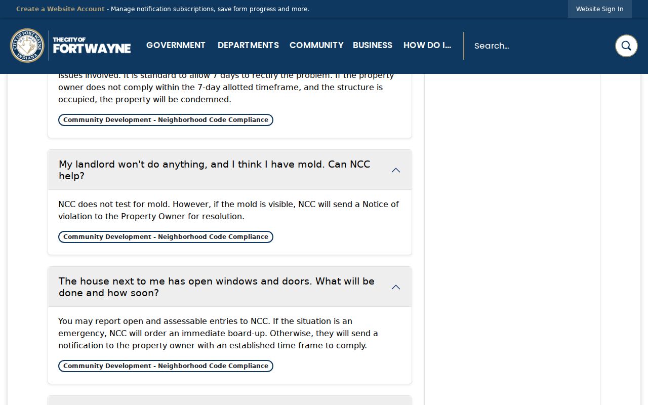
The capture reinforces the narrow use: it helps locate a dated city case, not a household list.
Fort Wayne Streets in Print
ACPL's city-directory run supplies the occupant evidence that parcel systems cannot. The Genealogy Center holds Fort Wayne City Directories for 1858 through 1998 under shelf mark 977.202 F77p and 1999 to the present under 977.201 AL5acd. Street cross-indexed volumes reach from 1927 forward, with the house-history handout specifically noting 1972 through 1998 cross-indexes. These dated books can place a listed household or business at an address.
Older volumes may arrange entries by name, while a criss-cross section reverses the order to street and house number. Telephone and association directories are only snapshots of their own subscribers or groups. For the collections, publishers, and edition-reading method, use the Fort Wayne city directory page rather than treating a printed listing as a current address.
Offline Fort Wayne Street Records
Web coverage has real cutoffs. The Recorder's core online run generally starts in 1970, COMPS shows current parcel data, and a library scan represents only the edition digitized. When a portal fails, use the office or collection that holds the underlying record.
- Ask the Recorder counter for the public terminal, older deed-book index, or a cited instrument.
- Call the Assessor at 260-449-7123 for parcel-card questions.
- Visit or contact the ACPL Genealogy Center for directories, maps, house files, obituary indexes, and microfilm.
- Use the Indiana State Library for historic maps, plat books, and microform directory runs.
- Send a focused APRA request through Allen County NextRequest when a department holds an existing record that is not posted.
Indiana APRA requires reasonable particularity. It does not force an office to create a new street-wide resident list. In-person and phone requests have a 24-hour initial response window; mail, email, and fax requests have seven calendar days. Production time depends on the record and needed redaction.
Limits of Fort Wayne Street Records
A property card names an assessed owner, not every person in the home. A deed identifies parties to a recorded transaction, not all occupants. Directory entries are dated observations and may omit unlisted people. The public voter portal checks a known registration with exact details; it does not reveal everyone on a block. Indiana's Address Confidentiality Program can protect qualifying voter information through a substitute address. Driver, juvenile, adoption, sealed court, and other protected records have separate limits.
Keep a compact research sheet with the source, date, address form, parcel key, role, and confidence level. Mark each person as owner, deed party, directory listing, applicant, or voter-status match rather than using the broad label “resident.” This protects both accuracy and privacy.
Lawful use. Use Fort Wayne address records only for lawful personal research. Never use them to stalk, harass, intimidate, or expose a protected address.